Visiting Iceland had been on the list for a while, so as we were looking for our next summer Europe trip, it was an easy choice. Vast landscapes, rugged weather and a plethora of outdoor activities was exactly what we had in mind, as Covid was still making its presence felt. We would be joined by two friends, Brittany’s childhood friend Emily and Nico’s former coworker Alen.
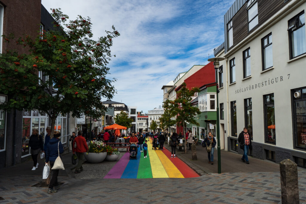
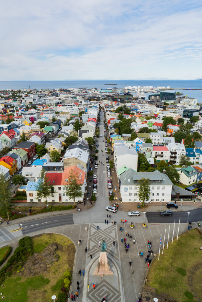
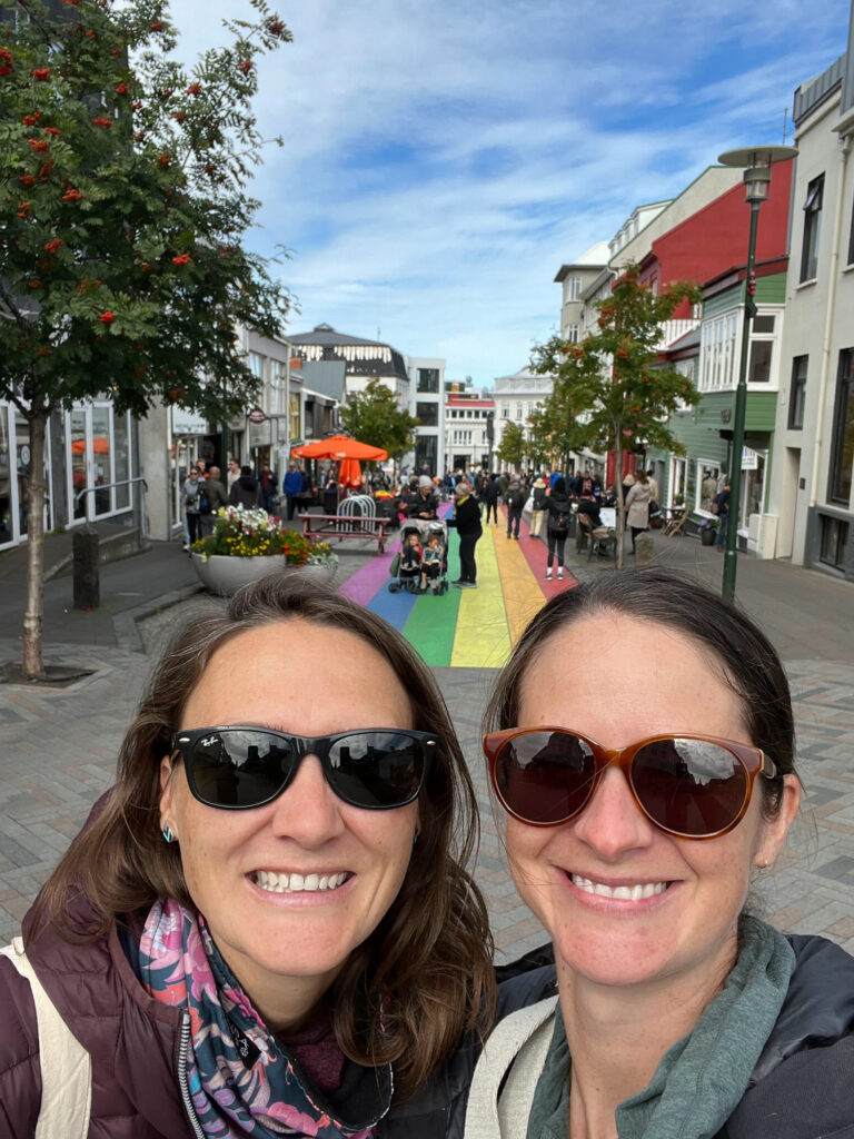
We arrived at the main Keflavik airport in the morning, picked up a rental car, and headed to a surprisingly sunny Reykjavik. We had the day to spend in town before an early morning start to the Laugavegur Trek the next day. Our Airbnb was conveniently located on the main pedestrian street Laugavegur (same name as our upcoming hike) which made exploring Reykjavik on foot very easy. First, we had a nice brunch at the Icelandic bakery/cafe Sandholt. Then we went on our self-guided walking tour, starting with the iconic Hallgrimskirkja church which is rarely seen under blue skies. From the top we were afforded great views of the colorful houses lining Reykjavik’s streets, and the water surrounding the peninsula on which the city is built. We continued down to the Tjörnin Lake and then to the city’s waterfront area. For dinner, we went to the Hlemmur food hall, where we had some delicious fish and chips and a banh mi sandwich (fun fact: there is a sizeable Vietnamese population in Reykjavik).
The next morning, our bus was scheduled for an early departure to the trek’s northern terminus Landmannalaugar. This was no ordinary bus, but one that was heavily modified with off-road tires, a raised drivetrain and a water sealed engine to be able to traverse the many stream crossings along the way. Iceland has a number of “F-Roads”, which are basically unpaved roads requiring a 4×4 vehicle, and the roads to and from the Laugavegur trek had especially deep stream crossings not suitable for normal 4×4 vehicles.
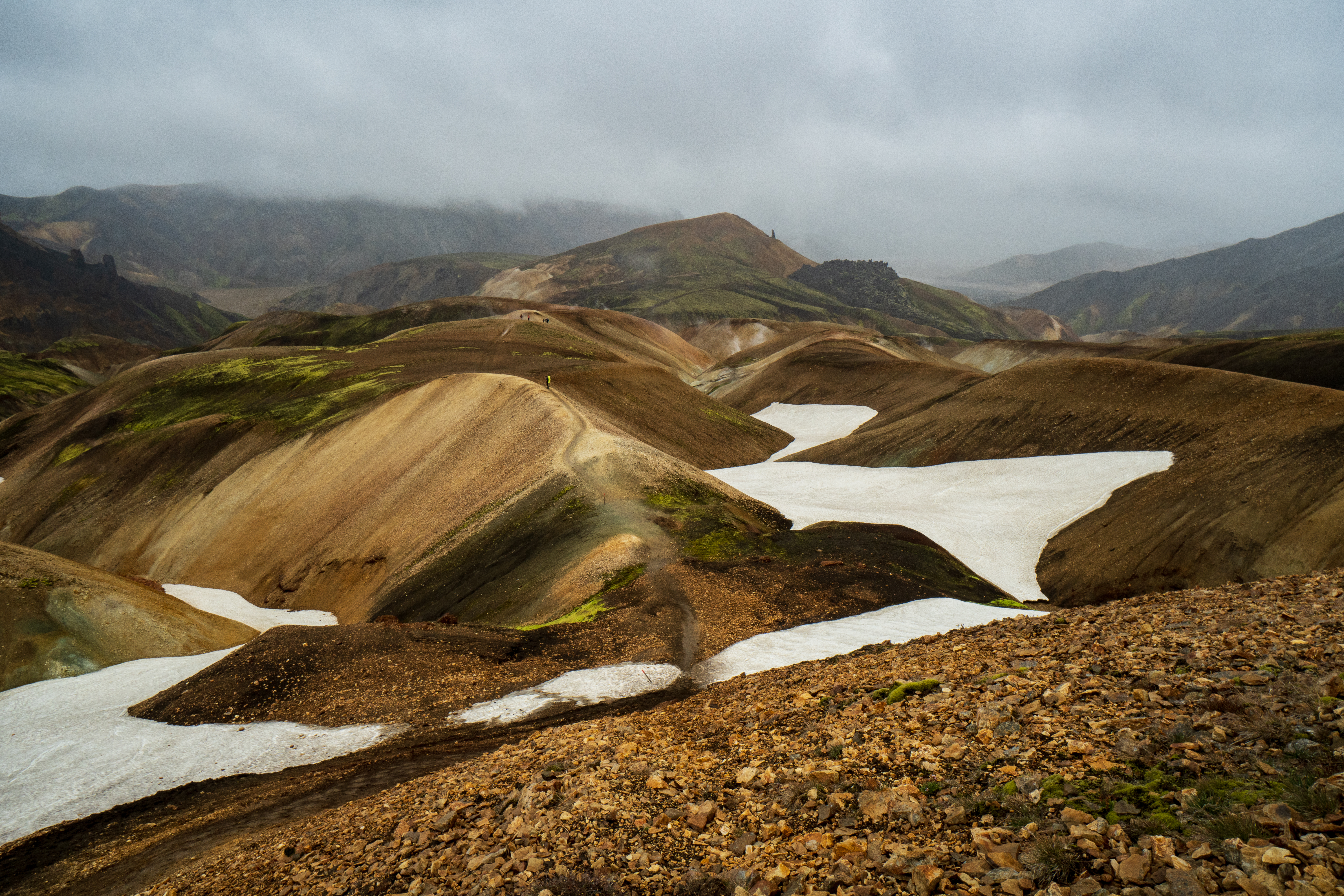
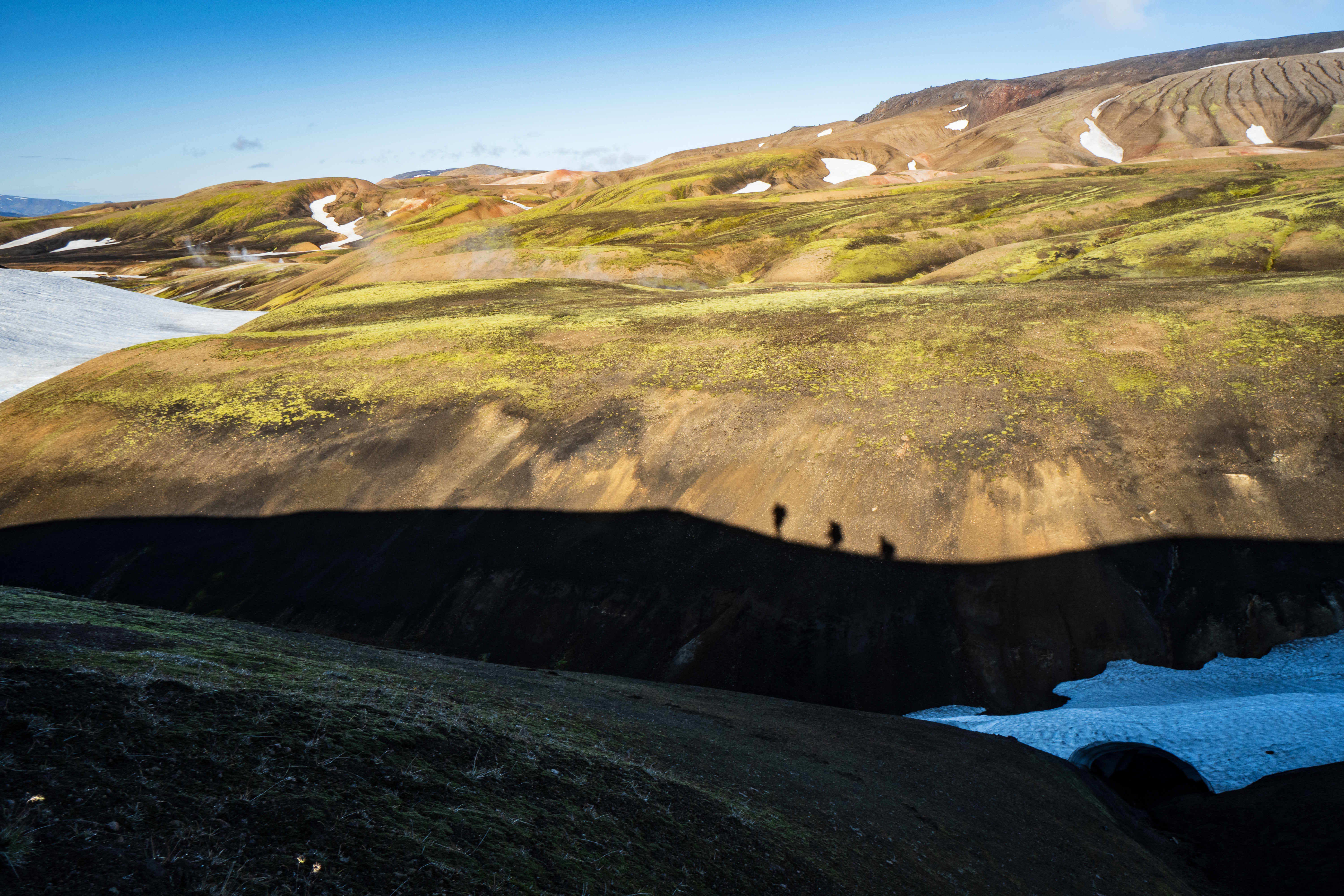
We arrived to light rain at the starting point huts around mid-day, ate our lunch, and were on our way. The rain was relatively light in the beginning, but persistent. We were still able to get some nice views of the colorful hillsides and geothermal vents for which this area is famous. As we ascended further, we started to cross snow fields regularly, the rain intensified, and we put on some layers. After a bit, it was nearly whiteout conditions, and we just followed the trail of footsteps across the snowfields.
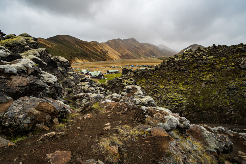
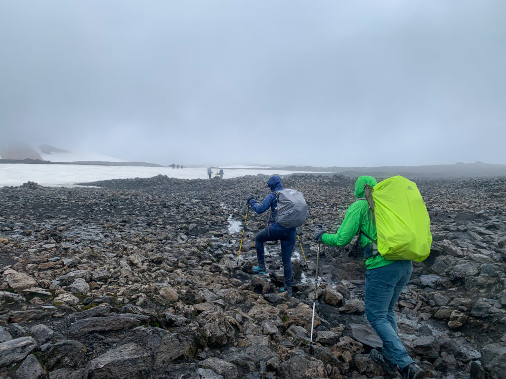
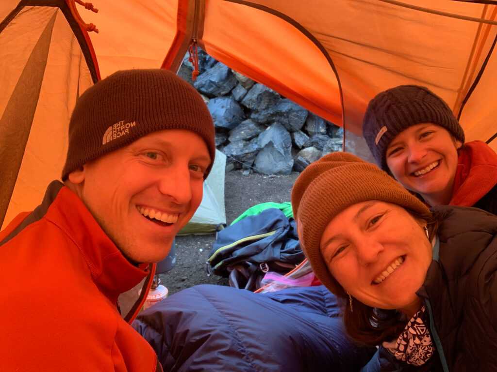
The first hut was Hrafntinnusker, which was located at nearly the peak elevation of the trek after around 7 miles in. We were wet by the time we arrived and setting up the tent in the rain is never a pleasant experience. There was slight relief when the hut warden told us that it would be a relatively mild night with “only” 2 C / 34 F low temperature and light wind in the forecast. Since it was still raining after we had finished setting up the tent, and the hut was packed with other hikers crammed into a small space, the three of us huddled up in one tent to warm up, share stories, cook our dinners, and sip some Icelandic vodka. The mild night was actually quite frigid!
Pro Tip: fill a Nalgene with hot water and stick it in your sleeping bag to keep you cozy throughout the night.
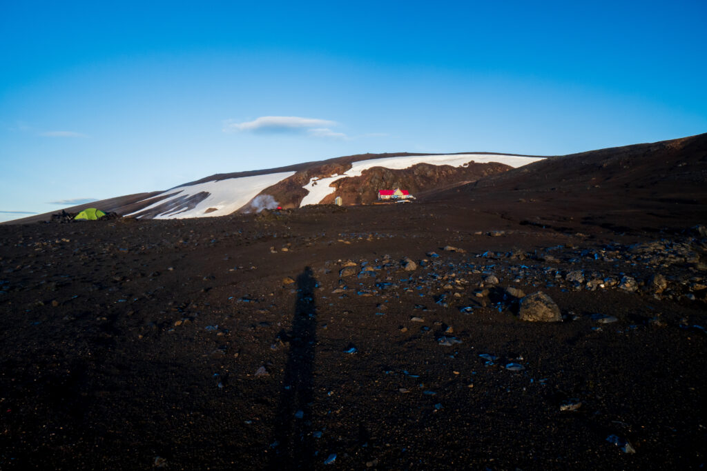
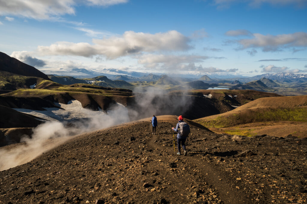
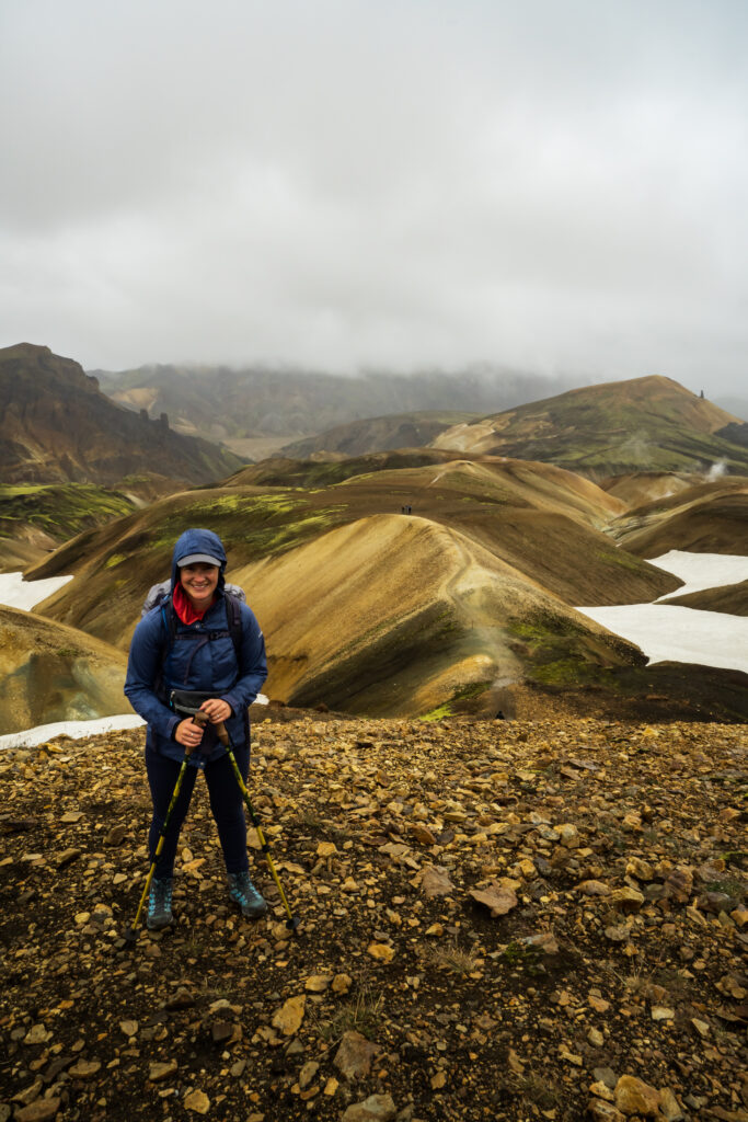
The sun rose before 6 AM, and after stepping out of the tent, we were treated to incredible views: rolling black rock hills partially covered with snow, occasional geothermal steam emerging from the ground, with the sun rising among scattered thin clouds beneath a deep blue sky. We ate breakfast, packed up camp, and eagerly went on our way on what would be a perfect, although long, day of hiking.
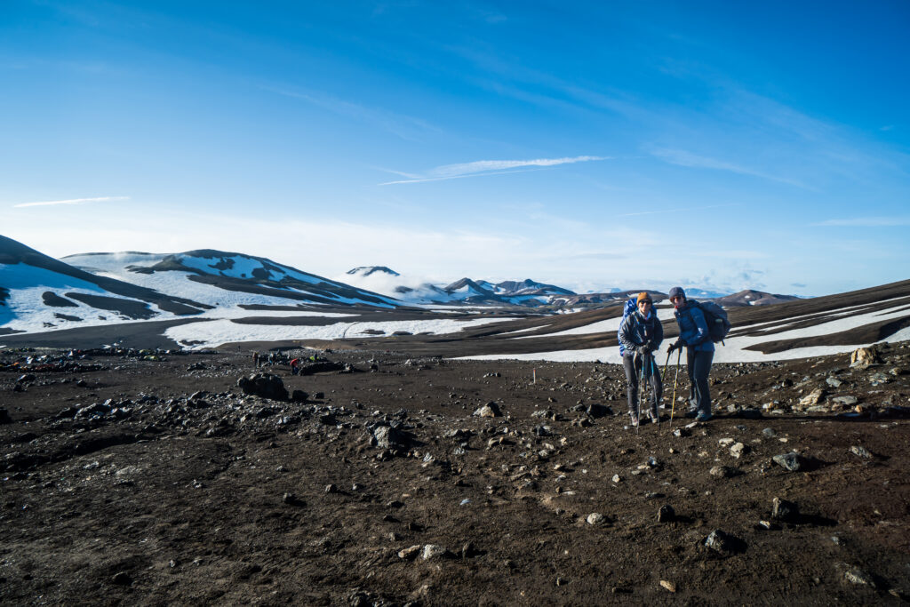
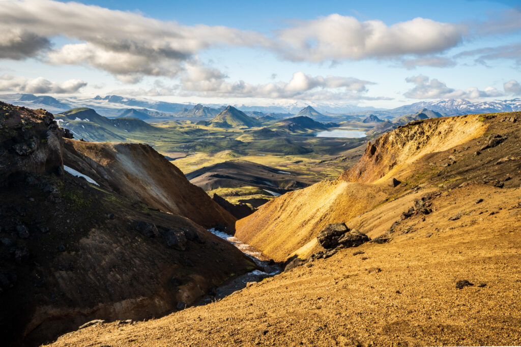
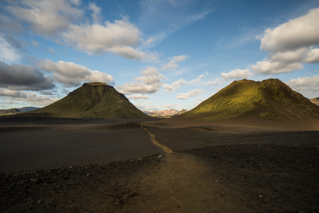
As we descended slightly, there were more green mossy patches and small streams. The path took several down-and-ups shaped by rivers before we arrived at a spectacular view over the valley beneath us. Along with some fellow American hikers, we called it the “The Land Before Time” view, named after the children’s movie set during the age of the dinosaurs.
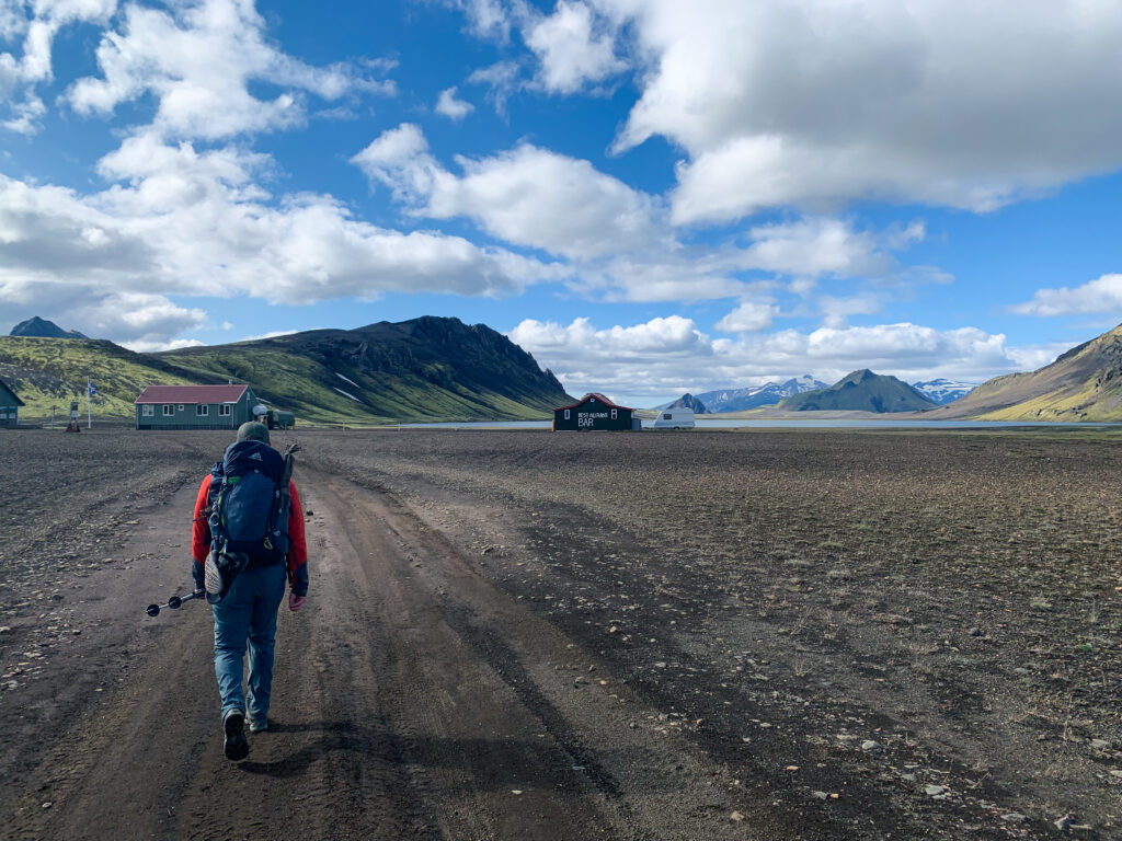
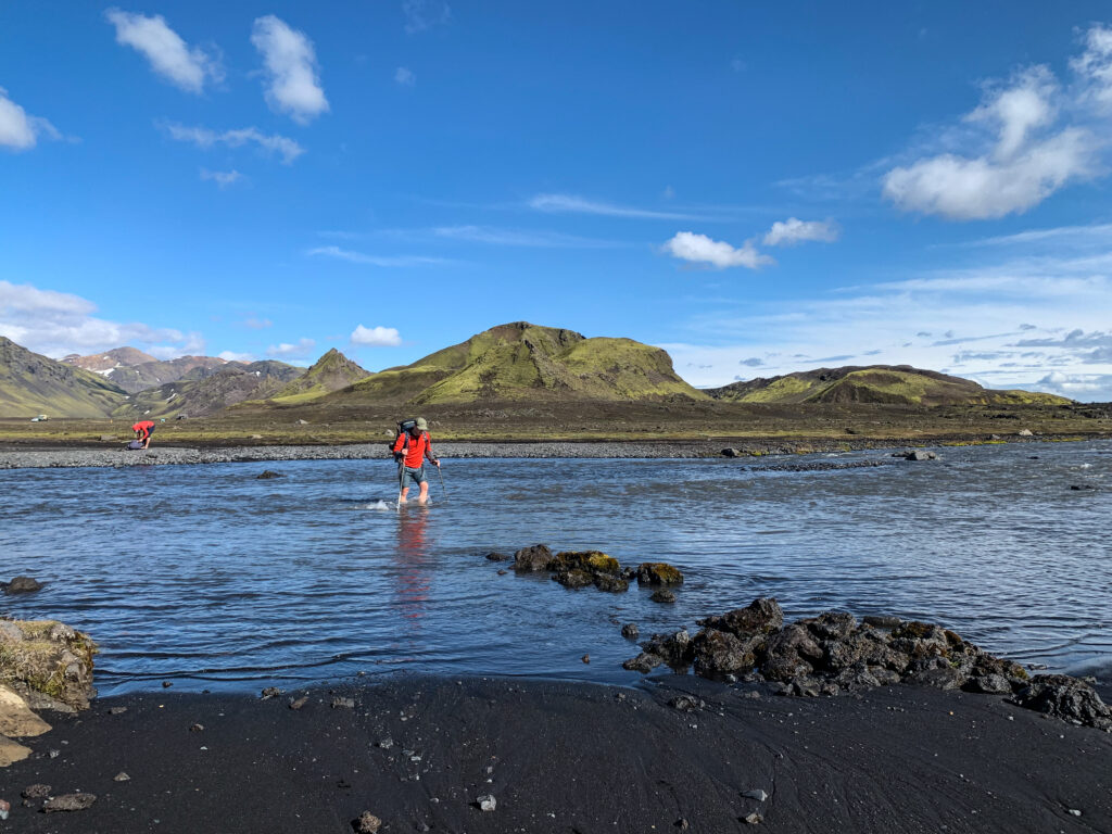
The path continued downwards into the valley, losing all the elevation from the previous day, until we arrived at the Alftavatn Hut situated on the shore of a lake with the same name. Here we had a warm soup for an excessive price (almost $30 each!), but we were happy to pay for the convenience. On our way out, the warden informed us that the upcoming river crossings were knee deep and thigh deep, so we were ripe with anticipation. The crossings didn’t end up being as bad as advertised, only ankle and just-below-the-knee deep in water, but still challenging with the currents. Having trekking poles and following other hikers’ suggestions on where to traverse was very helpful. Collectively there was a sigh of relief that we easily made it past them without taking a swim… though the painfully icy water still left an impression.
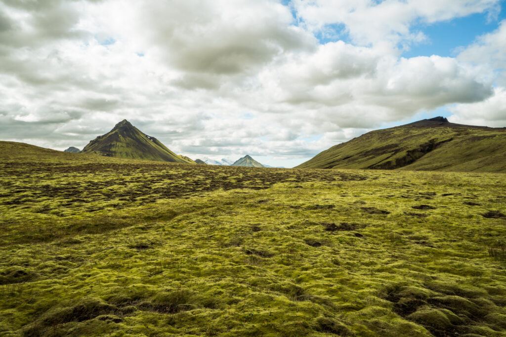
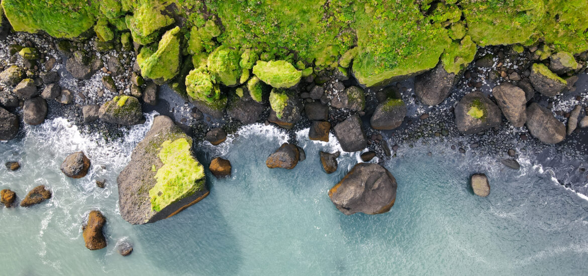
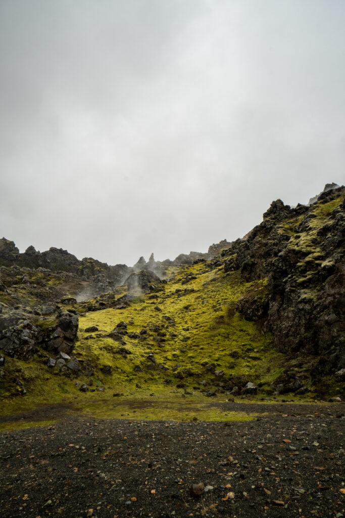
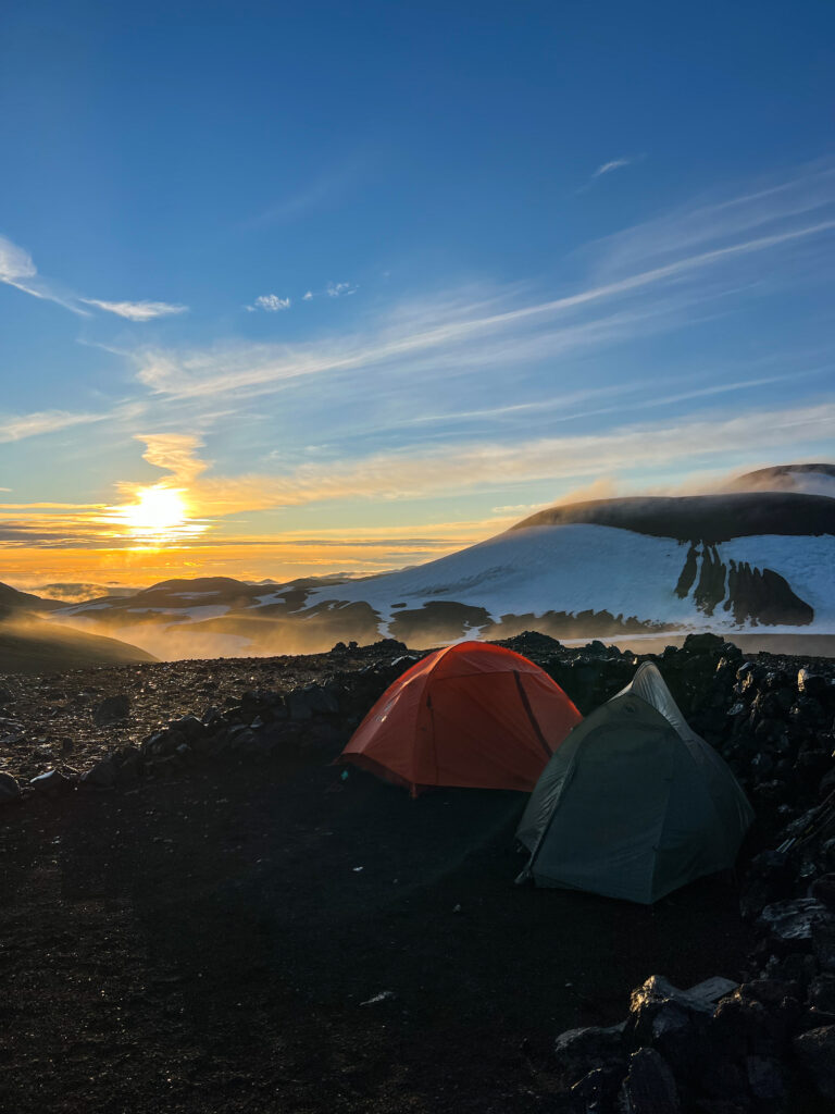
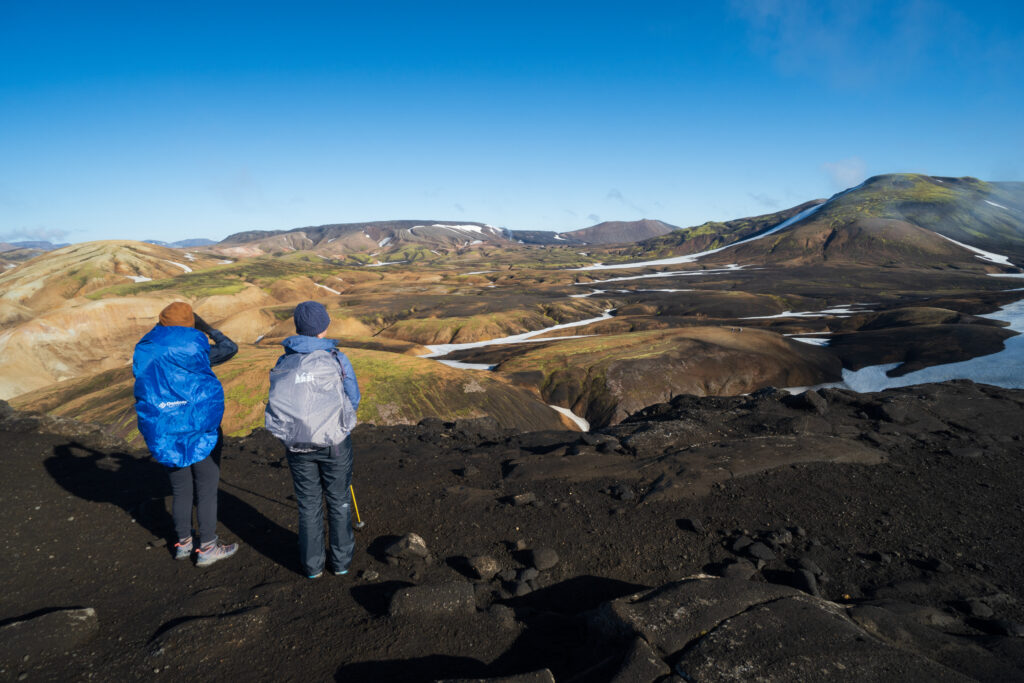
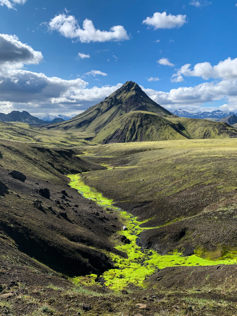
After the crossings, the landscape changed into something more reminiscent of a black desert or lunar landscape, occasionally traversing through isolated green-sided hills. It felt quite remote and very pretty in its own way. The last few miles of our 18-mile day dragged on a bit, morale was a bit low, and we couldn’t have been more excited to make it to the Emstrur Hut in the late afternoon. It was much more pleasant setting up our tents in the sun, making and enjoying dinner with warmer temperatures at lower elevation. The hut wardens also happened to have some beers for sale, which was welcome after the long day on the trail.
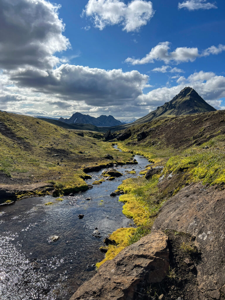
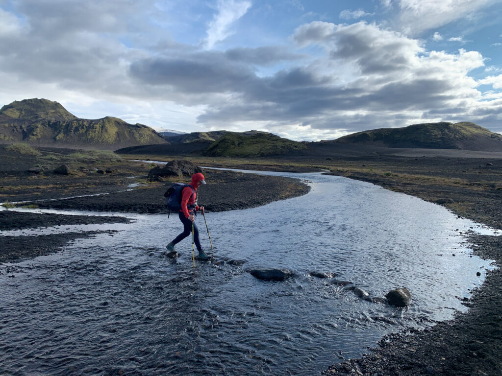
As we were waking up on day 3, we were discouraged by the sound of rain which kept us in our tents a bit longer than planned. We decided to pack everything up that we could, made breakfast under the community tent and held out hope that the rain would break. We timed it right and were able to pack up the tents in a mild drizzle that eventually cleared up by mid-morning. We initially crossed through a steep canyon with rushing water and then ascended again. The landscape continued to change, revealing more valleys and some wild sheep along the way. In the background, we could see the active Katla volcano covered by the Mýrdalsjökull glacier. After our last river crossing with the strongest currents, we entered a green forest among gentle green hills before arriving in Þórsmörk. The final 10 miles took us just under 5 hours, so we had a bit of time to eat a leisurely lunch and throw back a few beers with trek acquaintances before catching our shuttle out.
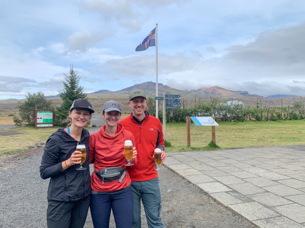
Since Alen did not join us on the trek, the initial plan was to have him pick us up with the “off-road-capable rental” at the ending point in Þórsmörk. However, after learning about the very real possibility of drowning the car in the deep river crossings on this specific route, which would leave us without insurance coverage, we changed course and booked another shuttle for the way out, which ended up being a wise choice. After reuniting with Alen, we made it to an Airbnb in Kirkjubæjarklaustur, in the southeast of the country, which would be our home base for the next three days.
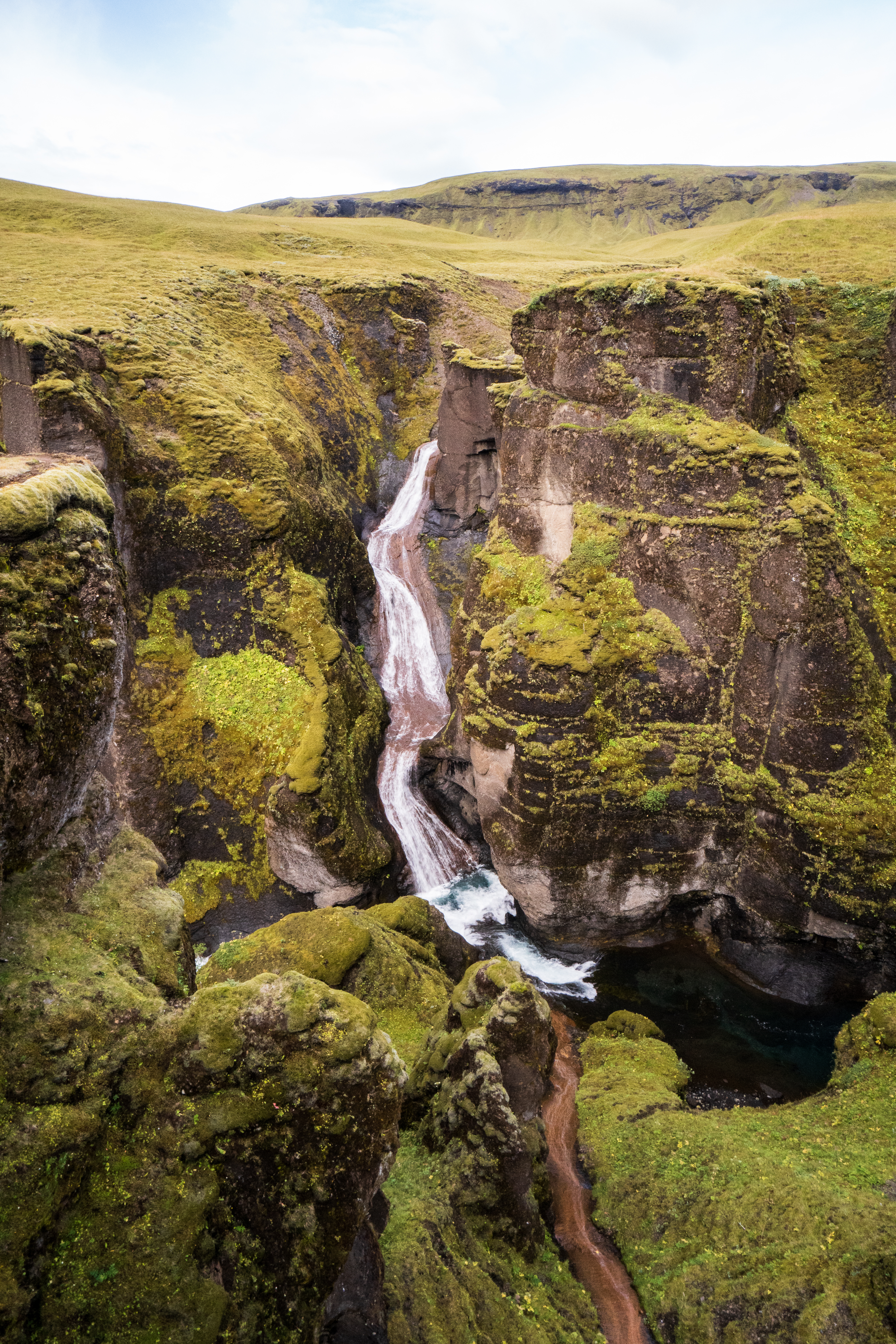
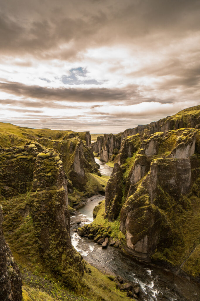
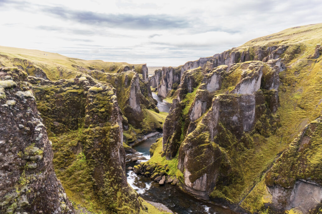
We were very close to the Fjaðrárgljúfur Canyon, a well-known stop along the ring road that circumnavigates the entire island. It was a deep canyon formed into the green countryside with waterfalls on many sides. We showed up early to beat the crowds but were still accompanied by many others on the single path along the canyon’s rim. As we arrived at the top viewpoint, a group in a tour bus was just leaving which gave us the platform to ourselves for a few minutes. We flew the drone from the lower parking area to get some top-down views of the canyon. The winds were quite strong, but we were happy to see that the drone handled them well. As we were leaving, there was a line of cars waiting for a parking spot in the lot or along the road.
Tip: arrive no later than 9 AM to Fjaðrárgljúfur Canyon.
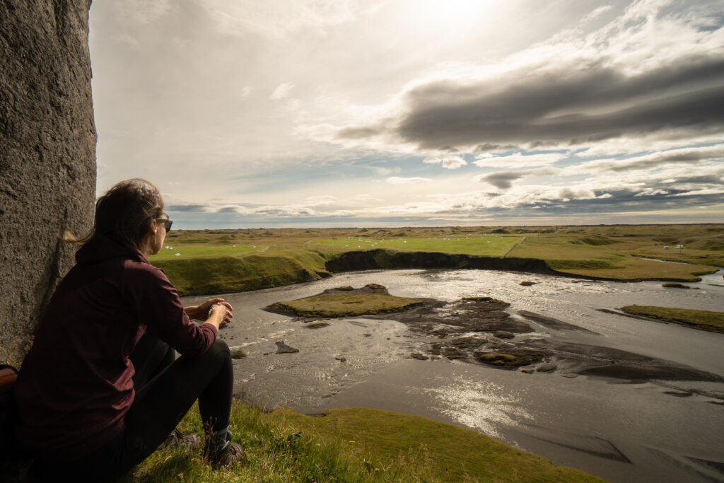
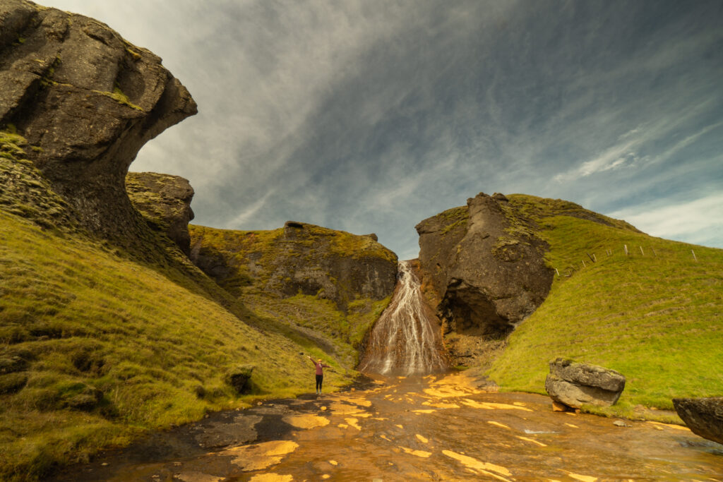
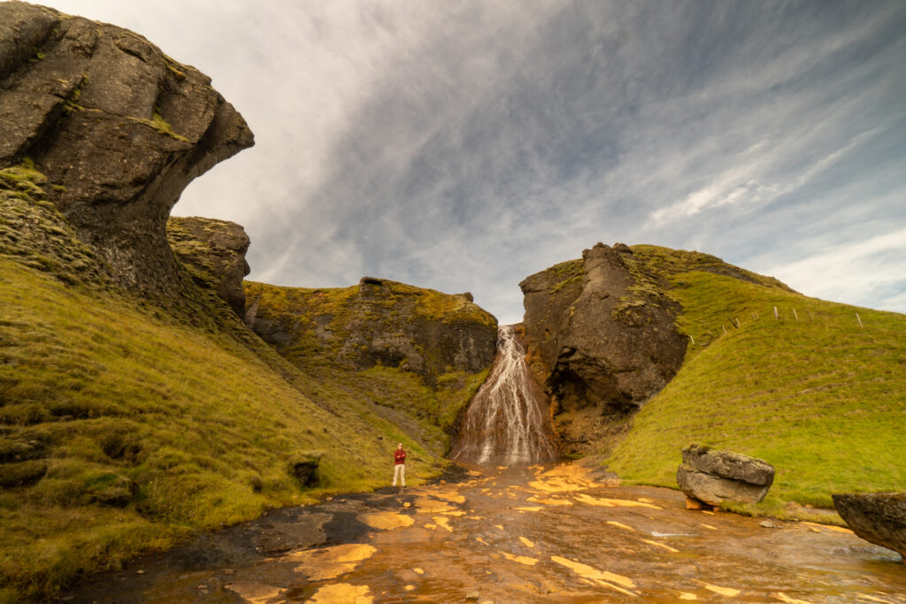
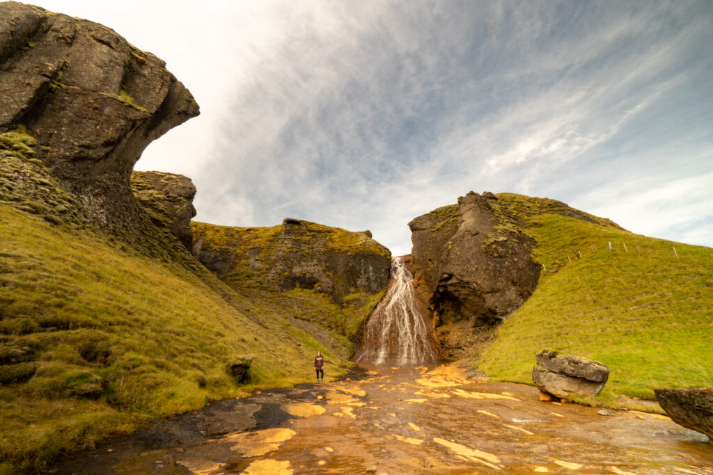
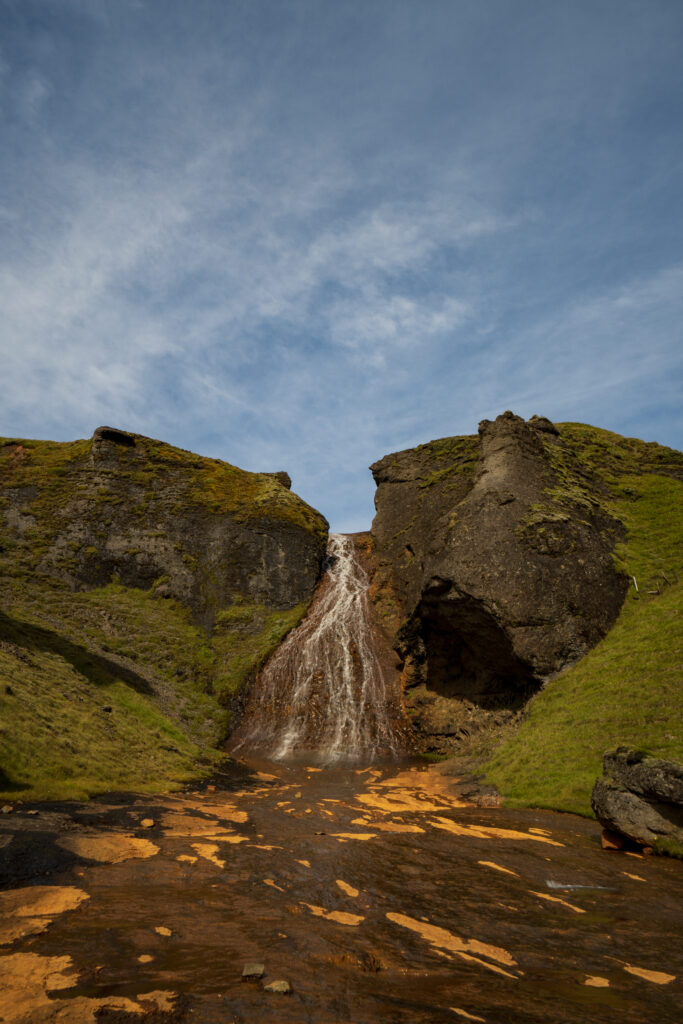
After visiting the canyon, we scouted out a lesser-known waterfall called Rauðárfoss, where we were happy to be the only visitors. We spotted a path leading away from the waterfall towards a massive freestanding rock and decided to explore. The path led us to Systrastapi (Sister’s) Rock; local legend believes that two sisters who were nuns are buried on top after having been burnt at the stake for blasphemy against the Pope. A small trail runs up along and around the side of the rock until it reaches a chain that can be used to ascend up the nearly vertical rock-face. After a careful deliberation, we decided it wasn’t worth getting stuck up top or falling down the steep rock side on the way back down. Therefore, we are sad that we cannot confirm whether the sisters are in fact buried there. The weather was pleasant and shaded from the wind, so we sat for a while and took advantage of the loose drone regulations to see more of our surroundings. Afterwards, we stopped for some time at the waterfall to take pictures with the tripod and enjoy the sunny weather and solitude before continuing for the day. Only as we were leaving did we cross paths with others.
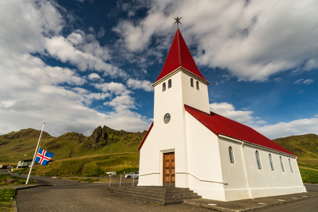
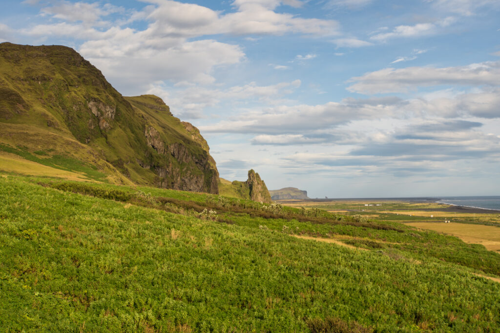
On our way to Kirkjubæjarklaustur, we passed through Vik for a quick bite to eat and a few groceries before continuing. Having not spent much time there the day before, we decided to go back to explore a bit more and get dinner. Vik has a black rock beach with jagged rocks that jut out of the sea just offshore. We found a spot to relax for a bit to fly the drone and enjoy a beer. We also visited the picturesque church that sits atop a hill overlooking the small town, before getting dinner at a cozy restaurant nearby. We had no expectations for the food in Iceland but came away pleasantly surprised by the quality and freshness of the offerings. Each place offered a vegan dish, and most meals were surprisingly creative and flavorful.
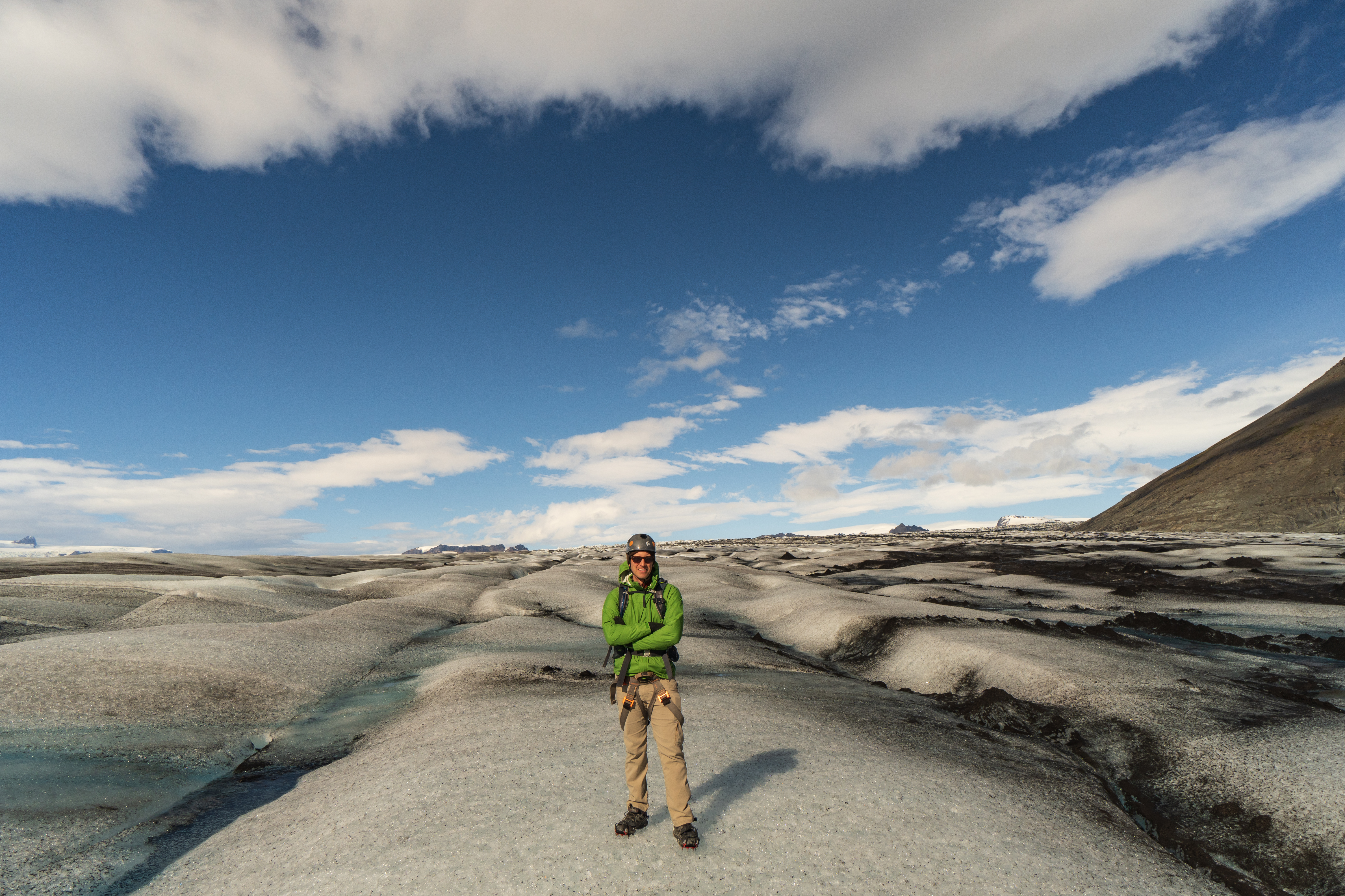
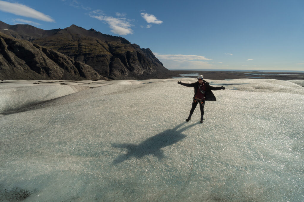
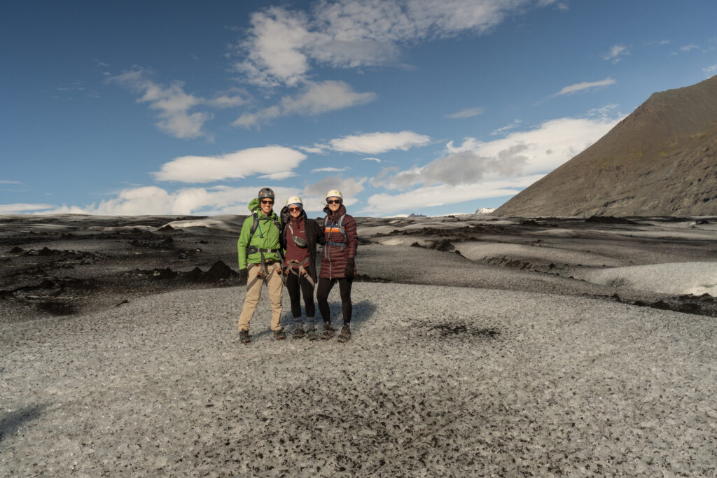
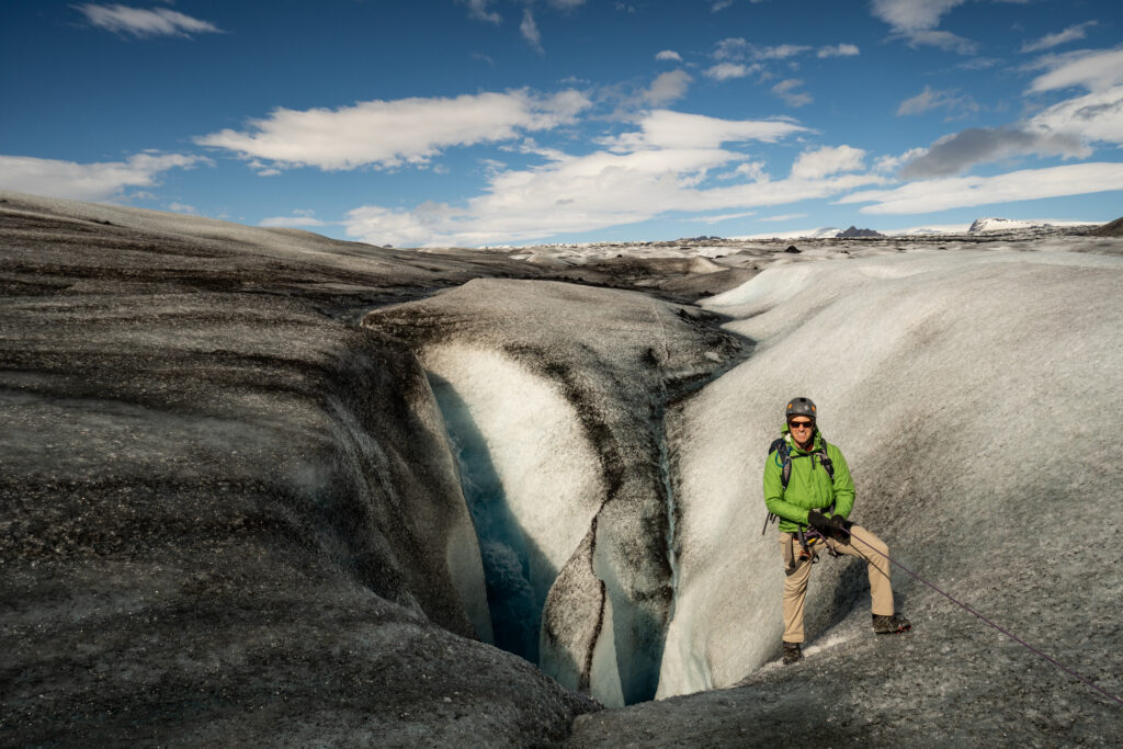
On the next day, it was time to venture further North-East to explore the Vatnajökull ice cap, the largest in Iceland. It was impressive to see the snow-capped mountains with different fingers of the glacier flowing down into the valleys. To start, we booked a glacier hiking tour with Glacier Adventure. After getting outfitted with crampons, harness and helmet, we drove to the Breidamerkurjökull Glacier. After a quick hike on dirt, we put on the crampons and got used to walking on ice. The glacier is gray/black near the bottom, due to the volcanic rock, and gets whiter further up. What looks like dirt mounds are really ice mounds with dirt on top, where the dirt insulates the ice and makes it melt more slowly than its surroundings. These mounds can get up to 5 meters tall. After a bit more time walking along the glacier, we were able to harness in and descend partially down a crevasse with a gushing flow of ice melt at our backs. Near the end of the tour, towards the bottom of the glacier, there was a large ice cave with a fast flowing river of glacier water running through it. It was very cool to explore the different parts of a glacier, but also sobering to learn that like others around the world, it was receding at several meters per year due to increasing temperatures.
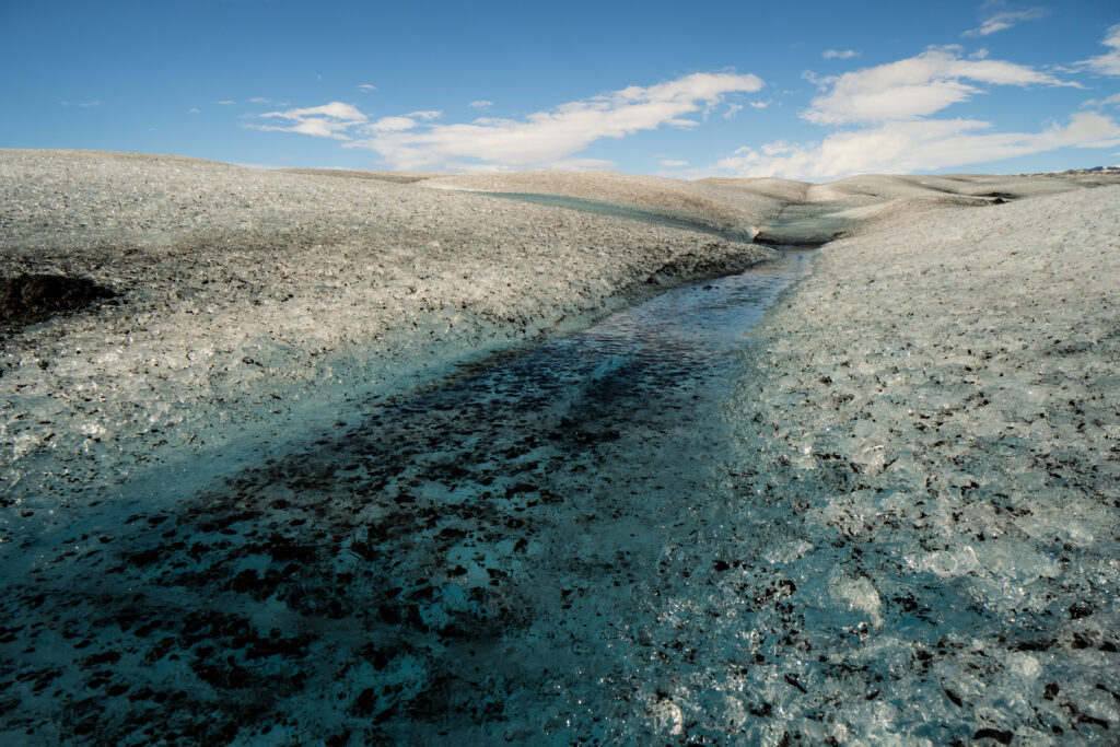
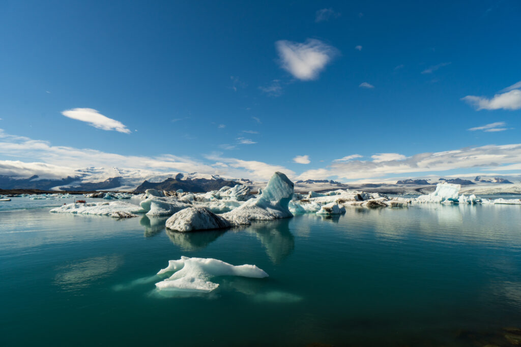
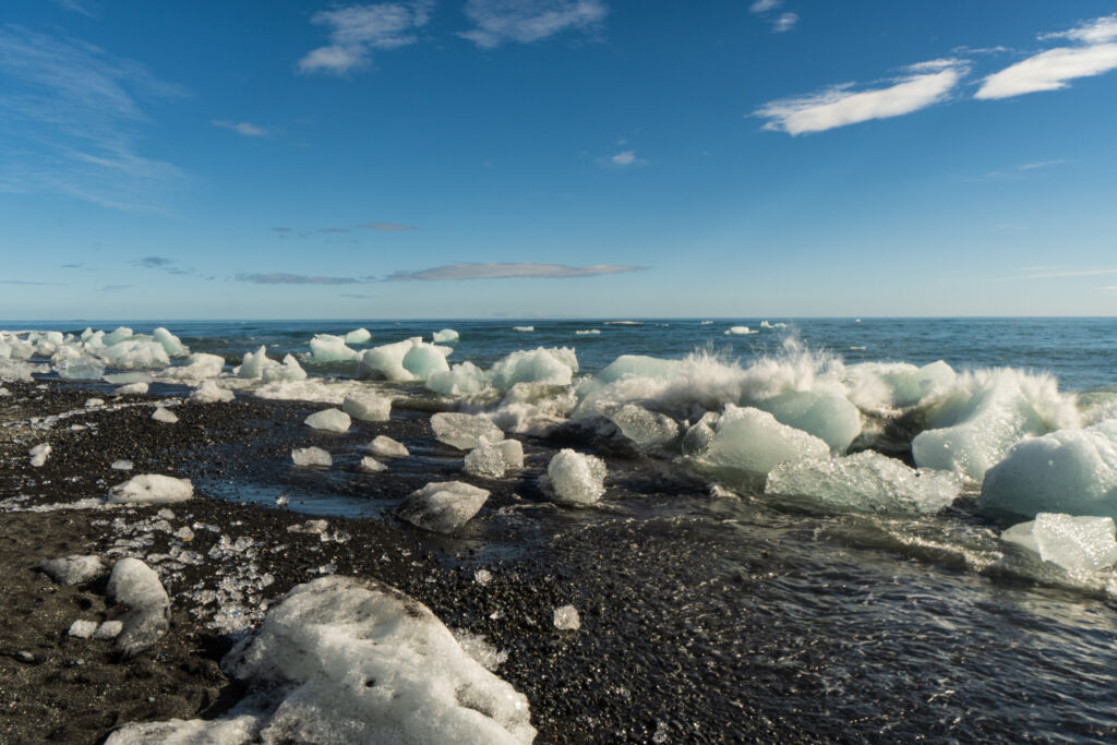
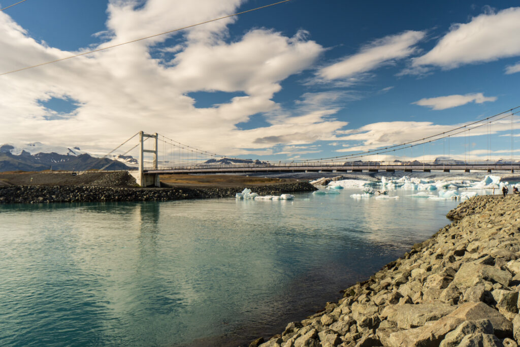
The nearby Jökulsárlón lagoon is another impressive sight, a lake with liberated chunks of ice from the glacier floating about. There were opportunities for boat and kayak trips, but we just chose to walk around. The ice chunks flow into the ocean through the lagoon’s outlet, so one can also see ice of various sizes washing up on the black sand beach.
At the end of the day, we treated ourselves to a delicious dinner at the local restaurant Kjarr. The Arctic char, found commonly in Iceland, and mushroom pasta were both excellent, as was the rhubarb crumble dessert.
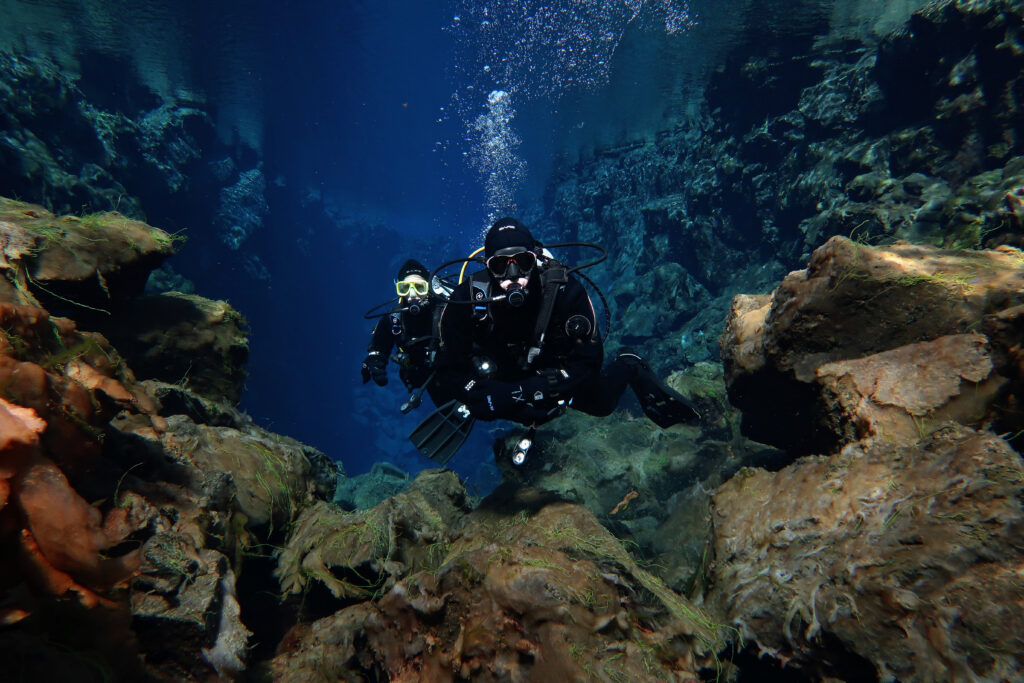
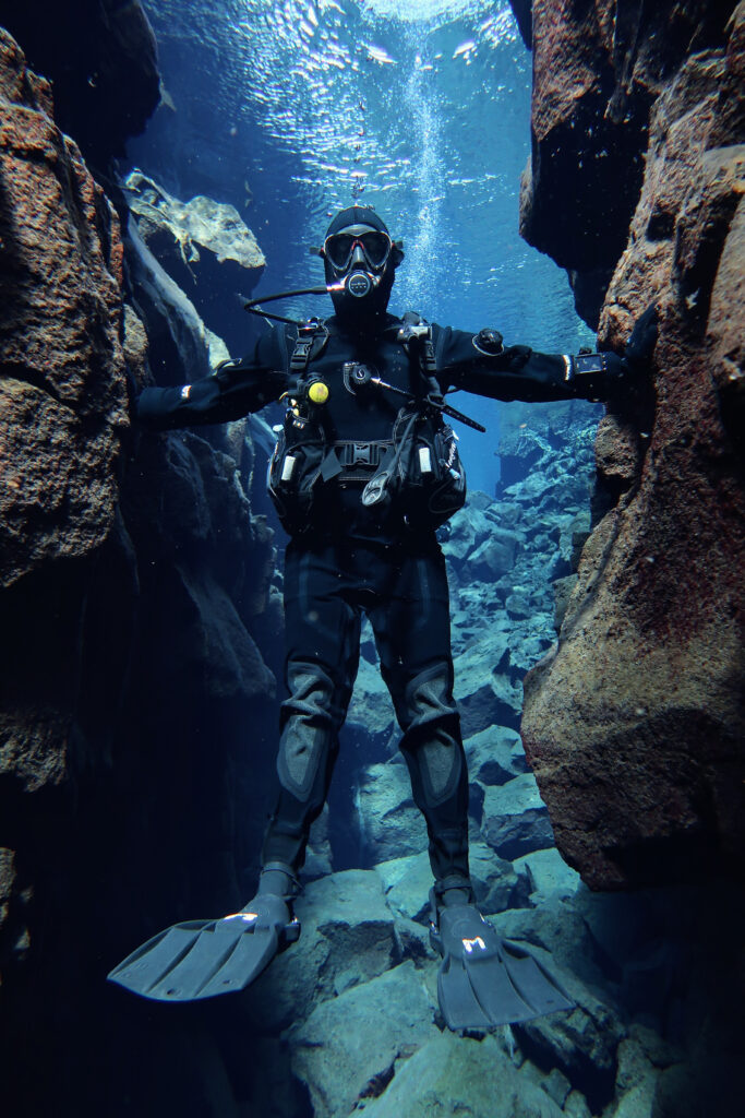
The next day, it was time to head back towards the Selfoss area near Reykjavik. An hour north of town was Þingvellir National Park, located in a rift between the North American and Eurasian tectonic plates. The tectonic forces act to pull the continents apart and result in cracks and fissures, one of which is known as Silfra. It’s filled with fresh water filtered through porous volcanic rock, a process that can take up to 30 years, and then empties into Þingvallavatn Lake. These crystal-clear waters make it a popular destination for snorkeling and diving, despite (or maybe because of?) the 34-38 F water temperature. Both activities are only done in what’s known as a dry suit, essentially a sealed outer layer, worn with thermal base layers underneath, to keep you dry everywhere expect your head and hands. We are both certified to use dry suits for California diving and therefore were able to take part in a dive, otherwise you have the option of snorkeling.
After getting geared up and listening to the briefing, we walked to the entrance steps. With the thick hood and gloves, and plenty of layers under the dry suit, it wasn’t actually that cold, initially. Occasionally a piece of skin would be exposed directly to the water leading to a temporary burning / stinging sensation, but it would pass after some time (really it just went numb). Our guide did a good job preparing us for some discomfort ahead of time, so we were ready. The visibility underwater was stunning – it was a rocky landscape with some algae growth and deep chasms underneath us. And for those wondering, no – there weren’t any creatures to be seen. We swam through a few different sections of the channel, at times almost having to surface to clear obstacles, and ended in a shallow lagoon. We spent about 45 mins in the water at a max depth of 35 ft. This was definitely a memorable experience and highly recommended on a trip to Iceland. The pictures are courtesy of dive.is guide AJ, since we didn’t lug our underwater camera along for this trip.
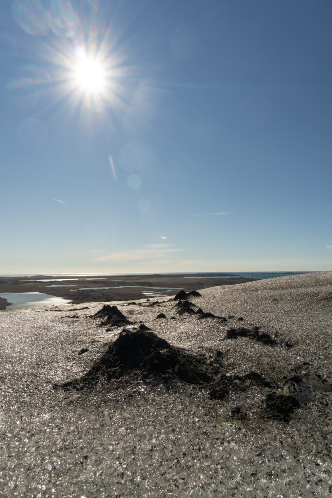
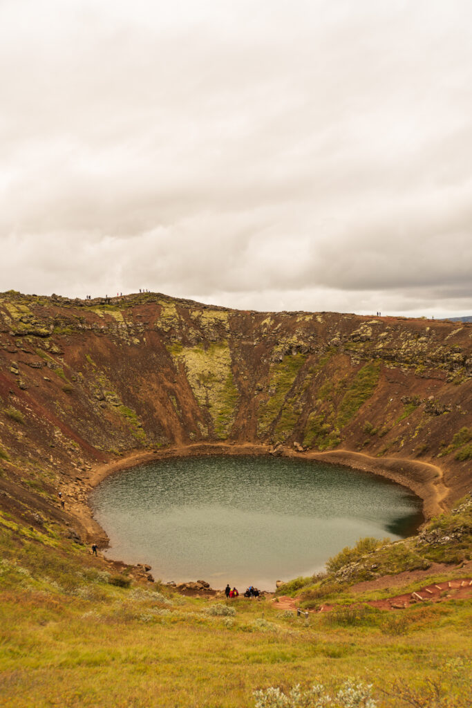
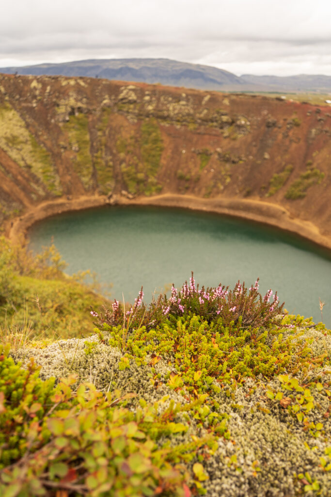
Our departing flight was late on the last day, so we had several more hours to explore by car. Kerið Crater was formed by a volcano and is one of the popular attractions on the Golden Circle. A short hike took us around the circumference of the crater, and we were able to get some cool pictures of the unique wall colors along the way (when other tourists weren’t in the way). After dropping off our friend Emily, we decided to check out some sites around the Reykjanes Peninsula. Krýsuvík was a geothermal area with hot springs and colorful soil. Next up we headed to an active volcano!
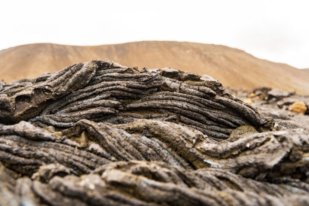
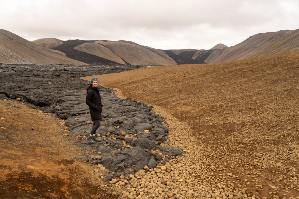
Just prior to leaving for Iceland, the Fagradalsfjall Volcano erupted, and we had hopes that we would be able to get somewhat close. Iceland monitors the eruption sites closely and allows tourists to get rather close by creating a network of trails and offering paid parking at the trail heads. We opted for a shorter trail that would take us to a lava field. We weren’t up for the longer 4-hour round trip to the top just before our flight. Seeing the lava field was spectacular on its own and gave us perspective on just how destructive they can be. Some cracks were still emitting steam, but the nearby lava rock was cool to the touch. We saw people walking on the cooled rock, despite posted signs warning visitors about the burn danger from the piping hot magma beneath what appears to be a hard, solid surface.
After exploring the volcano, we grabbed dinner in Reykjavik before heading to the airport for our flight to see family in Germany.
We experienced everything we wanted after 8 days in the Southern part of Iceland. The country is certainly no longer a hidden gem – over the past decade, visitor numbers have multiplied – and it shows, with lots of tour buses at the main stops, throngs of tourists at the grocery stores, and prices that correspond with this popularity. It’s unnerving to be in a crowd to see a waterfall and witness the trash that has been left behind. But there were still good opportunities to get away from the masses at less popular sites. The highlight of our trip was the Laugavegur Trek, which allowed us to see the changing landscapes of Iceland on foot. Hiking on a glacier was also a memorable experience which felt quite remote, and it was surreal to see newly formed volcanic soil. So, would we recommend it? Absolutely – the varied landscapes are spectacular. But know what you’re getting into and set your expectations accordingly.